NWS: Little chance of hurricanes likely from 2 current tropical systems
Published 1:56 pm Monday, August 9, 2021
|
Getting your Trinity Audio player ready...
|
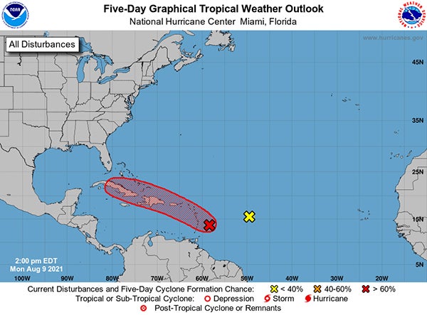
On Monday afternoon, an area of low pressure was located about 100 miles east-northeast of Barbados, and the associated showers and thunderstorms continue to show signs of organization, according to officials with the National Weather Service.
However, recent satellite wind data indicates that the system currently lacks a well-defined center. Environmental conditions are expected to remain conducive for additional development, and a tropical depression is likely to form later today or tonight while the low moves west-northwestward at 10 to 15 mph. It has a high (80 percent) chance of formation during the next 48 hours and five days.
The disturbance is forecast to move through portions of the Lesser Antilles tonight, then move near the Virgin Islands and Puerto Rico on Tuesday, and Hispaniola on Wednesday. Tropical storm watches or warnings could be required this afternoon with shorter-than-normal lead times for portions of the Lesser Antilles, the Virgin Islands, and Puerto Rico. In addition, heavy rains and flooding are likely for the Leeward Islands, Virgin Islands, and Puerto Rico. Interested parties in those areas should monitor the progress of this system.
Elsewhere, showers and thunderstorms in association with an elongated low pressure area located several hundred miles east of the Lesser Antilles have diminished. Environmental conditions have become unfavorable and development of this system is no longer expected. It has a near zero chance of formation during the next 48 hours and five days.
For more information, visit online at www.hurricanes.gov.
Information in this story was provided by the National Weather Service.